- Distinguishing vegetation-free land from grass or woodland
Smart Agriculture Software
AI supported smart agriculture software that can make inferences from plant species, yield forecasts, early plant disease detection and meteorological information with high resolution data (drone, satellite, lidar, etc...).
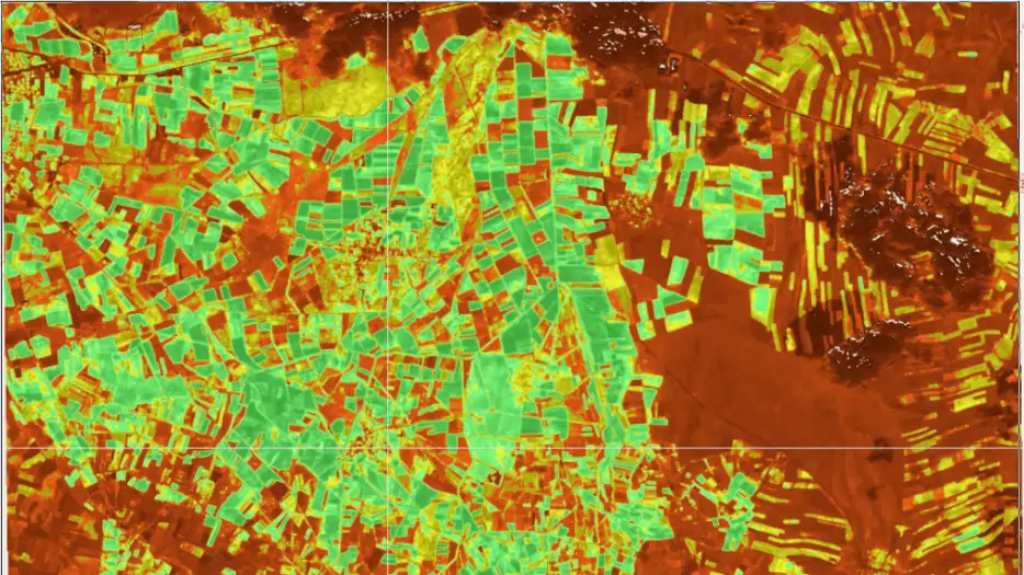
- Detection of different disease reflections spread over large areas with satellite images
- Applying pesticides to the needed area with early plant disease detection and minimizing drug consumption
- Obtaining higher quality products with minimum drug use
- Regular monitoring of agricultural areas and latest status reports
- Weather forecast and early analysis
Usecases
Plant Disease Detection
Water Use Management
Field Tracking
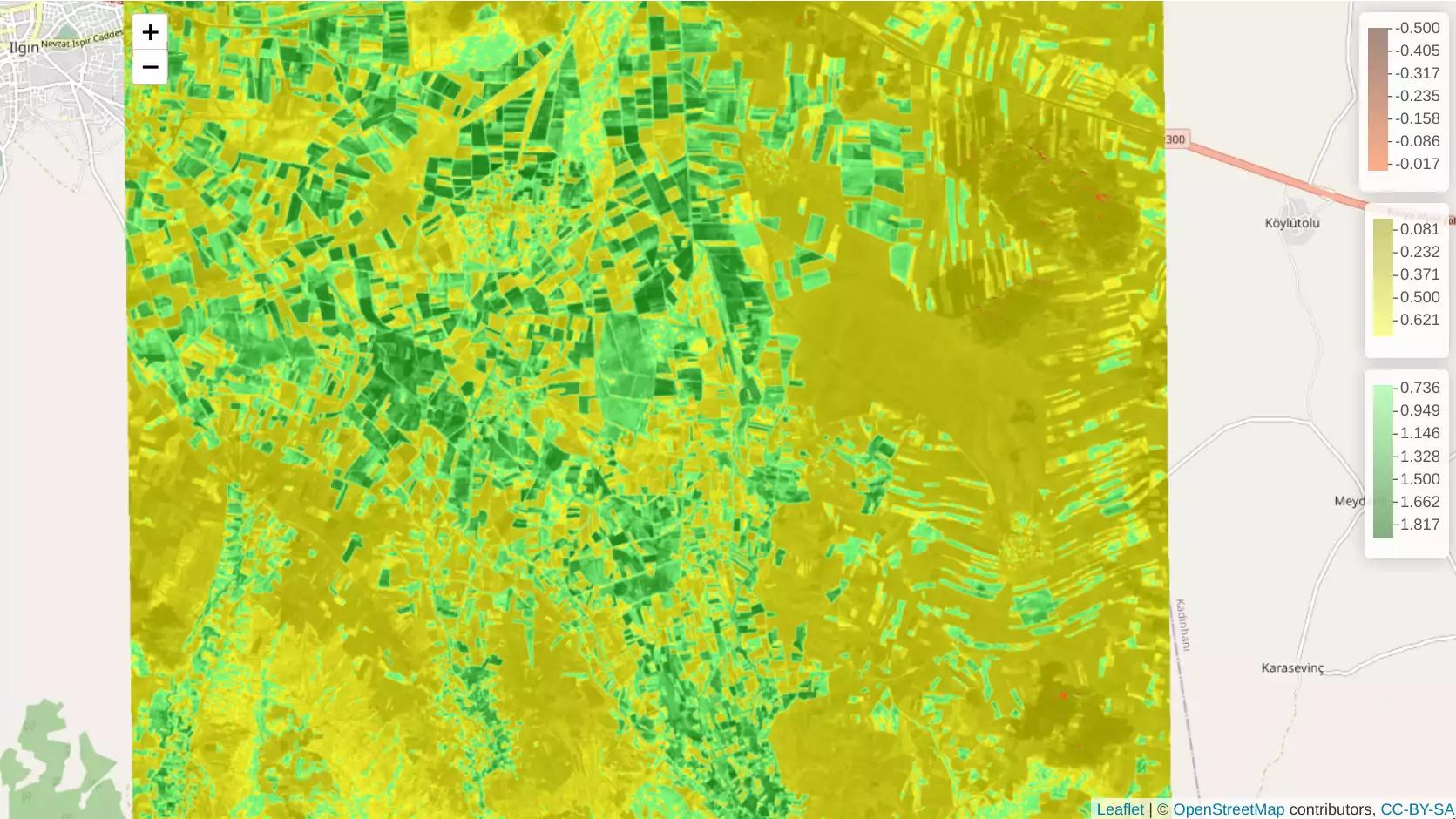
Satellite Imaging in Agriculture
- Able to detect sick plants and distinguish between the developmental stages of crops
- The ability to detect unhealthy crops in a field earlier than the human eye can detect (approximately two weeks in advance) with NDVI analysis
Efficiency In Agricultural Production
- To detect plant disease or drought early and to solve quickly before problems grow
- Accelerating the disease detection process and saving time with NDVI analysis instead of damaging plants with a lot of pesticides, spending fuel and spending employee effort with the tools used for disease detection
- Analysis of areas that can not be reached by vehicle with drone and NDVI technology
- Detection of dehydrated regions from satellite image with NDVI vegetation index
Smart Agriculture Reporting
- Real-time harvest forecasts to help optimize the supply chain and reduce losses
- Archiving all field files in one place
- Access the field file archive from any mobile device or desktop computer
- Detailed record tracking of crop type, acre and sowing information for each plot in the field file archive
- Field personnel-based monitoring, timely tracking of all tasks
- Automatic notification and alert on any problem
- Supporting many file formats (*.shp, *.ecw, *.dxf, *.dwg,*.kml, *.kmz, *.dem, *.dgn, *.gml, *.las, *. gpx, *.sid etc.)

Your industry/use case is not on the list?
Opwire offers you a wide range of solutions based on your needs with its flexible module structure.
Get Free Demo